-
 Anglický jazyk
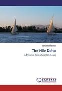
The Nile Delta
Autor: Mohamed Hereher
Over the last two decades, the Nile Delta of Egypt has experienced prolonged spatial changes due to two opposite forces: reclamation of the deltaic desert margins and urban encroachment upon fertile agricultural land. The primary driving force for this change... Viac o knihe
Na objednávku
44.35 €
bežná cena: 50.40 €
O knihe
Over the last two decades, the Nile Delta of Egypt has experienced prolonged spatial changes due to two opposite forces: reclamation of the deltaic desert margins and urban encroachment upon fertile agricultural land. The primary driving force for this change was the accelerated population growth at the delta towns. Satellite remote sensing was the tool utilized to investigate and analyze the change of the total agricultural land and the urbanization rates. Remote sensing was chosen to map agricultural land due to the unique interaction between green vegetation and the electromagnetic radiation from the sun. The regional coverage of satellite data coupled with the long time of imaging helped surveying and highlighting trajectories and the trade-off between agricultural land and urban landscapes. This book provides new techniques of remote sensing and GIS for mapping agricultural lands and for addressing and analyzing changes at the urban/agricultural interface. Results obtained in this book are significant to regional planners and urban developers.
- Vydavateľstvo: LAP LAMBERT Academic Publishing
- Rok vydania: 2011
- Formát: Paperback
- Rozmer: 220 x 150 mm
- Jazyk: Anglický jazyk
- ISBN: 9783845443874




 Nemecký jazyk